
Project 1 Where-It-Goes
Overview
The goal of this project is to build a prototype that can be taken on the road for logging purposes and analyzed in the future. The following project, Where-It-Goes, pin points locations by using a NavSpark with a SD card adapter
Functional Specification:
Where-It-Goes captures GNSS signals, generates coordination related information, and store the information in the NMEA format to an SD card. The user takes the SD card and uses an NMEA-to-KML program to transform the trace information to the KML format, which can then be displayed on Google Map.
Hardware Required:
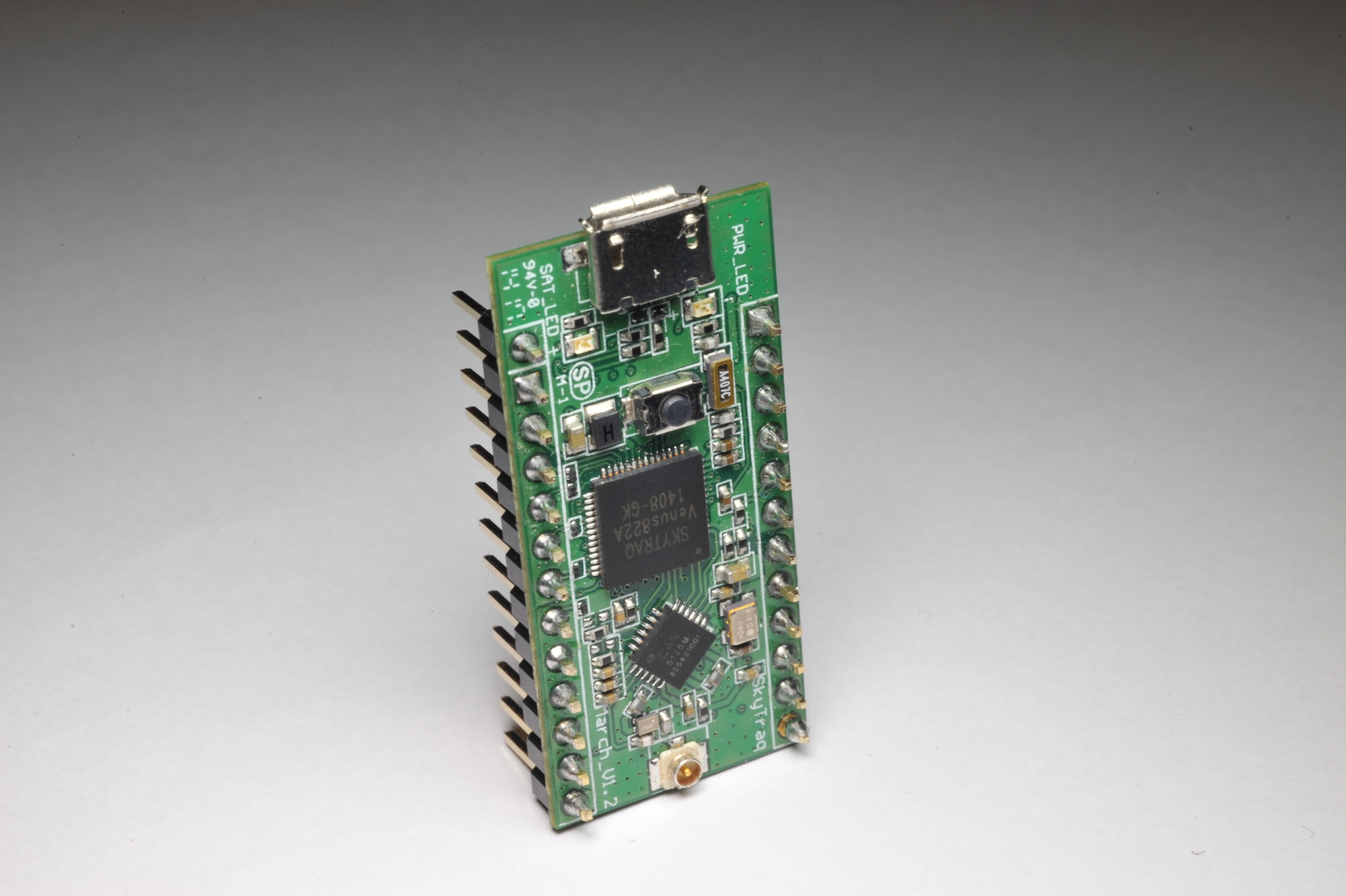
- NavSpark or NavSpark-GL or NavSpark-BD
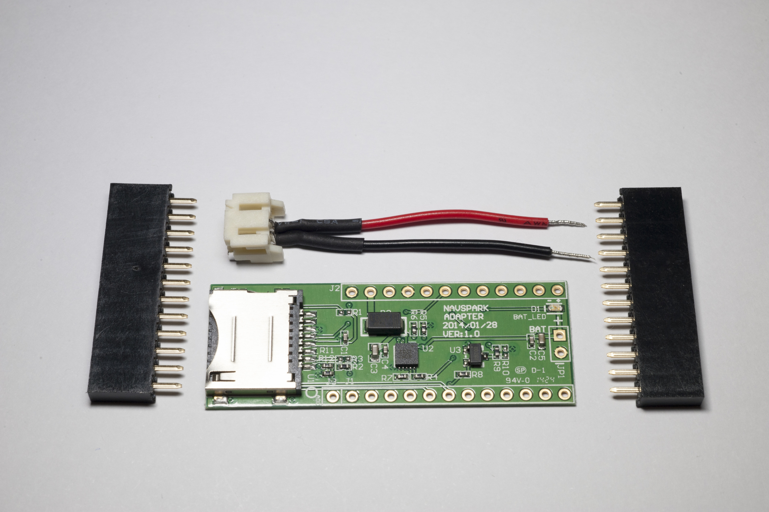
- Adapter Board for NasSpark
- Internal GNSS Active Antenna
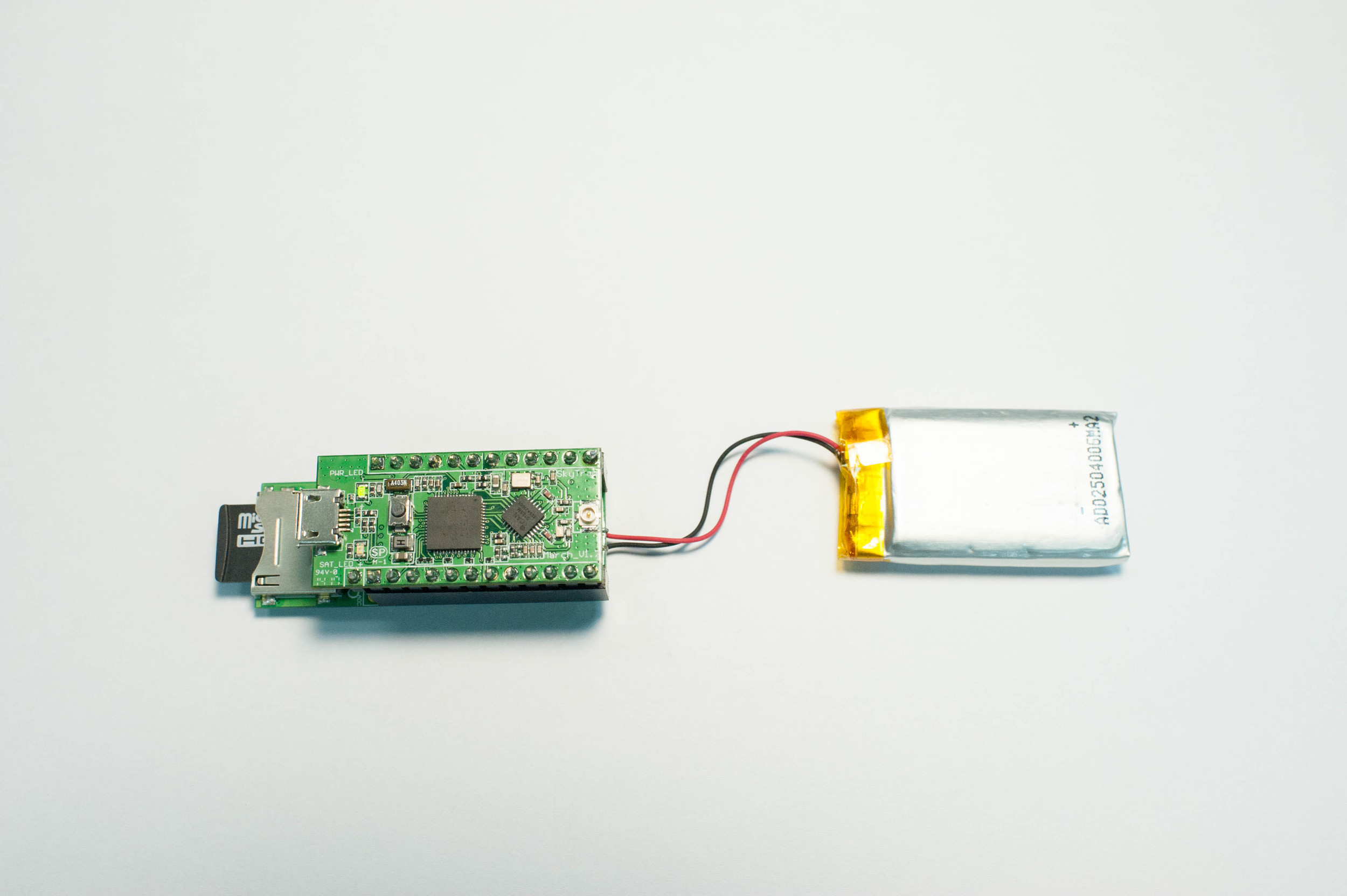
- Lithium Battery
- Micro SD Card Class 10 or higher


Information stored in NMEA format:
- Waypoints
- Direction
- Speed
- Altitude
- UTC Time
How to Use:
Tag Where-It-Goes to your dog, cat, quadcopter, vehicle, etc., anything that moves to record and replay its location and time history. See the trace on Google Map with your smartphone, tablet, or PC.
The data on the SD card can be imported into a spreadsheet for scrubbing, sub-setting, reformatting, analysis, and visualizing. We will also make use of the GNSS Viewer to convert our data to KML format and display it on Google Earth.
Format SD Card:
The SD card needs to be formatted in FAT32. Normally, most SD cards are formatted correctly out of the box. Insert the SD card into the adapter board.
Show an image here.
How to Connect NavSpark with Adapter Board:
1. Solder the Adapter Board with the lithium battery

2. Attach NavSpark with the Adapter Board

3. Press and hold reset button and place the SD card into the SD card slot
Let go of the reset button once the SD card is in the SD card slot
Download and Install:
Show some images and procedures here.
- How to compile this project via Arduino IDE
- Download the code to NavSpark
Operating Modes:
When Where-It-Goes is running, the LED on NavSpark has 3 toggling modes to display different logging status
1. Continuous Light - Power on, but there is no position fix
2. Slow Flash - LED toggle 2 times in one second. There is a position fix, but the SD card logger is not available
3. Fast Flash - LED toggle 4 times in one second. There is a position fix, and the SD card logger is writing results (NMEA).
The SD card logging will stop after there is no position fix.
Stopping
Once you see the multitudes of LEDs blinking away for a bit and you feel like it's time to stop, here is the safest way to turn off your NavSpark.
Where-It-Goes provides only one stop method when you lose position fix, but you can implement other methods to improve it.
1. Use a stop button via GPIO
2. Stop at specified time or a specified location
3. Stop at back to the start location
Low voltage detection: Low voltage operation may damage the SD card. You can use a low voltage detection circuit via GPIO to detect low voltage and stop the logging. In order to make this project brief and simple, we do not deal with this situation.
Reading Logged Data & Converting Formats
Now that you have turned off NavSpark and removed the SD card, place it in your computer's SD card reader and open GNSS Viewer to convert it to KML. You can import KML files into programs like Google Earth.
The following steps will show you on how to convert log data to KML and import into Google Earth.
1. Open GNSS Viewer and select "Converter" -> "KML"
2. Press "..." button to select datalog folder in SD card drive
3. Choose the convert options (in the following example, we checked "3D KML", "Point list", and "No Point Text"
4. Press "Convert" to finish the conversion
5. Browse the SD card drive, and you can see some KML files in the datalog folder. Double click the KML file to import it into Google Earth.
6. Now Where-It-Goes data is displayed in Google Earth